WWF-SIGHT is launched to the WWF-Network
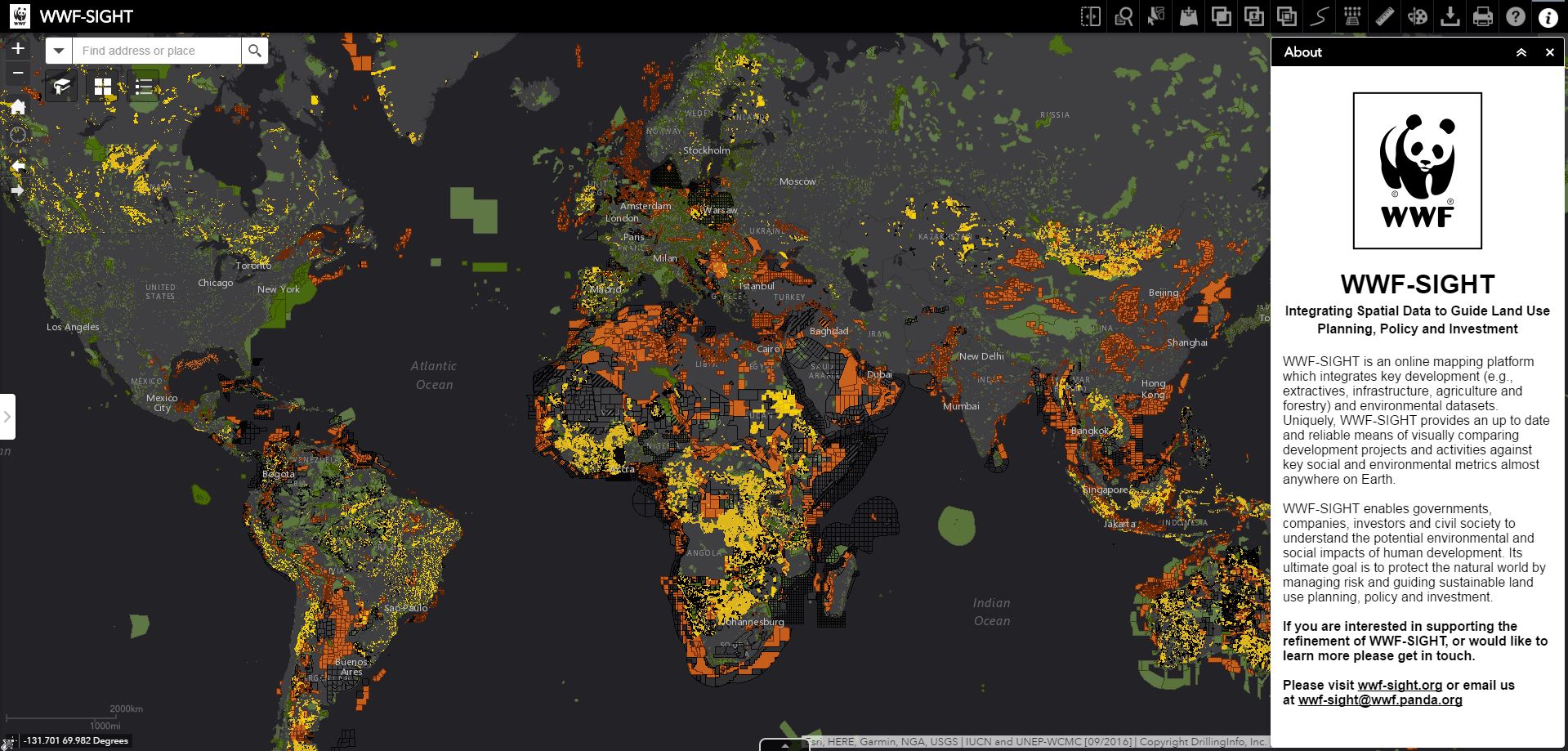
The online development and environmental spatial data tool and approach – WWF-SIGHT – has now been officially launched to WWF network users. The tool and associated approach, uses spatial data from all major environmental spatial datasets to engage with governments, investors and companies. As a result, it will allow WWF as a network to help protect the planet more readily and with better knowledge than ever. The use of the spatial mapping tool is restricted to WWF staff, but its results can be communicated widely where relevant to financial institutions, companies, governments and investors.
Nina Jensen, CEO, WWF-Norway said:
“As populations grow, so does the need for resources. Large industrial projects are emerging in different parts of the world which put pressure on the environment. We need tools like WWF-SIGHT to help us overview these large scale projects – to understand their environmental and social risks – in order to ensure that development goes hand in hand with environmental and social welfare.“
What is WWF-SIGHT?
WWF-SIGHT is an online mapping tool and approach that provides an up to date and reliable way of visually comparing and analysing development projects and activities against key environmental data almost anywhere on Earth. Key applications include an early-warning system through the rapid assessment and monitoring of emerging or existing developments (e.g., an exploration mining concession), and the assessment of potential environmental and social conflicts of projects. This provides crucial support for effective policy advocacy with governments, companies and investors. For example WWF-SIGHT can help bridge the gap between investment and potential impact of a project on the ground by systematically highlighting projects with high environmental risk to their ultimate owners and investors.
Nina Jensen, CEO, WWF-Norway added:
“One of the most innovative aspects of WWF-SIGHT, is that it finally allows WWF to establish the link between projects on the ground and investments. It enables us to work on the same issue at different levels; from assessing the risk of a certain extractive project in Tanzania to tracing back its investment in Norway, for instance. This way we are able to influence Norwegian investors to implement policies and practices that are in line with the SDGs.”
Up-to-date extractives (oil, gas and mining) and other human development spatial layers (e.g palm oil, forest concessions) can be integrated with environmental data such as the World Database on Protected Areas, Intact Forest Landscapes, Key Biodiversity Areas and IUCN’s species grid. Without needing to be a GIS expert, the data can be visually considered, analysed to provide key metrics, and exported for use in engaging with stakeholders.
Susanne Schmitt, Extractives and Infrastructure Manager, WWF-UK said:
“We are very excited to launch WWF-SIGHT. The online tool now allows anybody in WWF from a field officer to policy staff to produce a simple map, showing potential environmental and development overlaps right up to using SIGHT analysis as the evidence base for policy advocacy with companies, investors or government agencies. Through easily accessible spatial intelligence, WWF-SIGHT enables WWF to engage early on planned infrastructure or industrial development. Early engagement can be more constructive and has more chances of positive influence for the environment before major investments are made and the development path is set.”
How has WWF-SIGHT been used so far?
WWF-SIGHT has helped power the data and information needed for WWF’s recent work in protecting World Heritage Sites through the #SaveOurHeritage global campaign. WWF-SIGHT provided the key evidence base for what constitutes the main potential industrial threat, namely oil, gas and mining, whereby more than 30% of all natural World Heritage Sites are potentially threatened. Specific evidence has been provided in particular for Selous Game Reserve, which is overlapped by 54 mining concession and one Oil and Gas concession.
The data has also informed the ‘Safeguarding Outstanding Natural Value’ report, produced by WWF, Aviva Investors and Investec Asset Management. It outlined the risk to investors of involvement with extractives companies owning concessions over natural World Heritage Sites. A coalition of investors is now actively engaging with companies to encourage no-go commitments for World Heritage.
The tool has been developed by WWF Norway and WWF-UK with the aim to become an easily accessible and user-friendly WWF network spatial application across the WWF International Practices that can be applied to a wide range of environmental issues.
Editorial Notes
WWF-SIGHT is currently restricted for the use of WWF and partners. Public access may not be granted. Publishing of analysis and data derived from use of the mining and oil and gas layers and requires the use of particular disclaimers.
For more information, please contact a member of the WWF-SIGHT core team at wwf-sight@wwf.panda.org