Mtwara Development Corridor
The Ruvuma landscape is considered one of last great wilderness areas of Africa, hosting two major reserves (Selous Game Reserve and Niassa Reserve). WWF’s vision for the area is that by 2030 it is preserved and provides local livelihoods and regional and national economic development for present and future generations. WWF-SIGHT has helped generate maps and spatial information to inform the Strategic Environmental Assessment (SEA). WWF-SIGHT has helped highlight some of the with the possible impacts of the Mtwara Corridor road and railway transportation lines, which cut across key wildlife corridors within a suite of protected areas.
Interactive map of the Mtwara Development Corridor(Click on top left of the map for more info)
Planned developments in the Mtwara Corridor
The Ruvuma landscape is a transboundary landscape straddling southern Tanzania and northern Mozambique, a vast area of 290,000 sq km. The Mtwara Corridor bisects this vast landscape connecting significant inland resources with port access, unlocking inland development potential. This resource corridor was identified in late 2004 with the signing of the Mtwara Development Corridor Agreement among the four countries of Tanzania, Mozambique, Malawi, and Zambia. The purpose of the corridor is to promote trade and investment in the four countries by improving and integrating transportation and other infrastructure (e.g., roads, bridges, ports, railway lines, telecommunications, and airports) in what is considered an underdeveloped part of East and Southern Africa. It includes Infrastructure development (road and railway) between Mtwara Port (Indian Ocean) and Mbamba Bay Port (Lake Nyasa) with extensions to the coal and iron mines of Mchuchuma & Liganga in Njombe Region. The overall project also includes building of the Unity Bridge connecting Tanzania and Mozambique, a high capacity ferry linking Nkhata with Mbamba Bay, and the Mtwara port with the discovery of significant oil and gas reserves in the basin. The countries committed to unlock the development potential of the region that is rich in natural resources, an effort that aligns with priorities of the AU/NEPAD. However, this corridor cuts through a globally significant biodiversity rich area that provides critical ecological services locally, regionally and globally.
Importance /Significance of the area
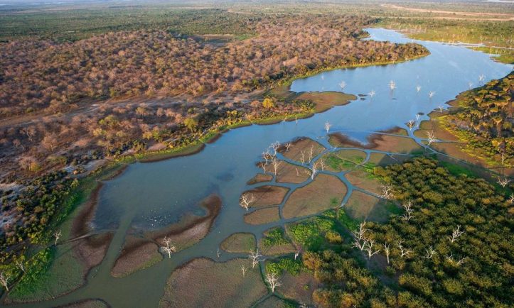
The Ruvuma landscape is considered one of the largest and last great wilderness areas of Africa, hosting two major reserves (Selous Game Reserve and Niassa Reserve) is home to vast natural resources and biodiversity. Key Wildlife Corridors/Dispersal Areas exist between Selous (WHS) and Niassa Game Reserves and support one of the continents largest remaining populations of elephants. Indeed the Niassa Reserve is home to 43% of Mozambique’s elephants, though there has been a loss of 2/3 of the population in the last three years. The area includes a number of WWF’s ecoregions (Miombo Woodland, Eastern African Coastal Forests, Lake Niassa/Nyasa/Malawi, and Eastern African Marine) and various protected areas (Quirimbas National Park and Niassa Reserve in Mozambique, Selous Game Reserve, Lukwika-Lumesule Game Reserve, Msanjesi Game and Mnazi Bay Marine Park in Tanzania), spanning a diversity of ecological types and habitats. Indeed, Tanzania last remaining natural forests on public land can be found here within Village Forests Reserves. Marine resources also abound, including Mnazi Bay Estuary Marine Reserve (Ruvuma River Mouth/Delta) and Coral Reefs/Mangroves in Mtwara (Tanzania EEZ).
Key Threats
These critical biological resources are threatened by increasing development and investment in the region, including those associated with the Mtwara Corridor itself including other industrial scale development such as the planned mining of Uranium at Mkuju River adjacent to Selous Game Reserve, the planned development of the Stiegler’s Dam for hydropower generation inside the Selous Game Reserve. This is the up-and-coming threat in the region. In addition, more traditional clearing for agriculture, charcoal manufacture, burning and hunting impact populations and destroy and fragment natural habitat. However, development of the Mbamba Bay-Mtwara transportation infrastructure (notably the road and railway) risks fragmentation of the key wildlife corridor routes between the two major reserves. Increasing transportation infrastructure further encourages the expansion and emergence of unplanned settlements which fragment habitat, disrupt movement of wildlife, and facilitate access for illegal activity from logging to poaching. Poaching is, in fact, at a very high level across the area, and even fishing methods at the coast are destructive and uncontrolled.
WWF Objectives of the project/effort
WWF’s vision for the area is that by 2030, the outstanding and globally significant natural wealth in prioritised areas of the transboundary Ruvuma landscape are sustained, and support equitable and gender-sensitive local livelihoods and regional and national economic development for present and future generations.
Key in shaping the future of the region, given the large, potentially landscape-changing scale and types of proposed projects and investments, are decisions about how these developments should unfold. This requires building the capacity of key decision-makers and relevant stakeholders to think through and understand potential future development scenarios and how their future development patters should unfold. Indeed, given the overall lack of development across the landscape, this is a rare opportunity moving forward.
WWF has had a strong presence in the region for years, and in December 2014 embarked on a scenario planning exercise with Tanzanian and Mozambican stakeholders and decision-makers to support understanding of the changes going on in the region and future visioning. This brought to the forefront issues of resource use and development. Thus, when the Regional Administrative Secretaries for Mtwara and Ruvuma Regions had to do their Regional Development Plans, they saw this as an opportunity to better understand the environmental and social strategic considerations for their regions. In 2015, WWF supported the development of the Strategic Environmental Assessments (SEAs) as basis for the Mtwara and Ruvuma Regional Development plans. SEAs are a key tool to upstream decision-making about environmental (and social) aspects, ensuring a policy level assessment, review of cumulative impacts, and enabling decisions to be made before project-level Environmental Impact Assessments (EIAs) come out, when options have already become fairly limited.
To support the SEAs, which were conducted by the University of Dar es Salaam’s Institute of Resource Assessment (IRA), WWF produced conservation and development maps with WWF SIGHT. These maps were able to highlight the probable path of the Mtwara Corridor road and railway transportation lines, which clearly cut across key wildlife corridors within a suite of protected areas.
Interventions – Policy Influence with Spatial Planning
These maps support conservation and sustainable utilization/management for livelihoods of the natural resources of the greater Mtwara corridor area and Ruvuma landscape more broadly. Locally decision-makers have suffered from lack of credible and up-to-date information that can be used to influence decision makers in the region. Key is promoting integrated management of resources, particularly those of a transboundary nature (forestry, wildlife, land etc.), through spatial planning (land use planning and strategic planning processes), scenario planning processes, and supporting bilateral relations (Mozambique and Tanzania) on tackling illegal activities on natural resources. Towards these ends two key policy intervention were identified as critical in addressing threats and challenges from increasing development and expansion of infrastructure in the region.
Regional development plans. Updated Regional Development Plans will come out in 2017, providing an opportunity now to influence such plans. Both Ruvuma and Mtwara Regions will integrate their SEA outcomes into development of these plans. Indeed there is intention of exploring how these data can further be used for District and Village plans, and feed up accordingly. Key issues to be highlighted from mapping involve agricultural and mining expansion against conservation and protected areas, forest degradation to charcoal, poles, timber, unplanned settlement expansions with economic activities, land acquisition for mining and agriculture, and infrastructure development across protected areas. The information is key for Regional Secretariats to lead these planning processes.
SEA implementation. Already SIGHT has provided information for the regional SEAs themselves in terms of identifying potential key conflict areas between development and the rich natural resources. In particular, the following aspects are important to visualize and plan for: Expansion and improvement of small and large-scale agriculture ii) Development and intensification of agro-processing industries iii) Planning for settlements and infrastructure development iv) Energy Sector Development v) Promotion of tourism based on natural resource base and vi) Development of water related infrastructure.
Next Steps
The final SEAs have been completed, and these, in addition to more direct SIGHT analyses, will feed into the development of the Regional Development Plans.